The Sundarbans mangrove forest, one of the largest such forests in the world is formed at the delta of the Ganges, Brahmaputra and Meghna rivers on the Bay of Bengal. The largest Contiguous Mangrove belt in the world is Sundarbans.
Total area of the entire Sundarbans is about one million hector, 60% of which is found in Bangladesh and the rest in India. For its Trees and Wildlife, the forest is a showpiece in the natural history of the World. Because of the dominance of saline conditions, the forest flora in the western Sundarbans is not as diverse as in the east.
Forest areas are dominated by a few species mostly Sundri and Gewu and patches of Nypa palm and several other of the 27 species of mangrove that are found in the Sundarbans. The fauna of the three sanctuaries, however, is very diverse with some 40 species of mammals, 260 species of birds and 35 species of reptiles. The flagship species is the Royal Bengal Tiger of which an estimated 350 remain in the Bangladesh Sundarbans. Other large mammals are wild boar, spotted deer, Indian otter and macaque monkey. Five species of marine turtles frequent the coastal zone and two endangered reptiles are present – the estuarine crocodile and the Indian python. Crustacea (fiddler and mud crabs) accounts for the largest portion of the animal biomass.
DATE AND HISTORY OF ESTABLISHMENT:
DATE AND HISTORY OF ESTABLISHMENT:
All wildlife sanctuaries were established in 1977 under the Bangladesh Wildlife (Preservation) (Amendment) Act, 1974, having first been gazetted as forest reserves in 1878. The total area of wildlife sanctuaries was extended in 1996. The entire Sundarbans is reserved forest, established under the Indian Forest Act, 1878.
AREA:
AREA:
Total area of Bangladesh section of Sundarbans is 595,000 ha of which 139,699 ha are protected as follows:
Sundarbans West Wildlife Sanctuary with 71,502 ha, Sundarbans East Wildlife Sanctuary with 31,226 ha and Sundarbans South Wildlife Sanctuary with 36,970 ha. Sundarbans National Park (133,010 ha), a World Heritage Site, lies to the west in India.
FOREST AREA LIMIT and GEOGRAPHICAL LOCATION:
FOREST AREA LIMIT and GEOGRAPHICAL LOCATION:
It is located between 21”30’-22”30’N, 89”12’-90”18’E.
North Side à Khulna
.jpg)
PHYSICAL FEATURES:
The Sundarbans, covering some 10,000 sq km of land and water, is part of the world’s largest delta (80,000 sq km) formed from sediments deposited by three great rivers, the Ganges, Brahmaputra and Meghna, which converge on the Bengal Basin (Seidensticker and Hai, 1983). The total area of the Bangladesh Sundarbans is 5,771 sq km (almost 62 percent of the total), of which 4,071 sq km is land and the rest water (Christensen, 1984). This area is approximately half the size of the area of mangrove that existed 200 years ago, the other half being cleared and converted to agricultural land (Hussain and Archarya 1994)


MAIN ATTRACTIONS:
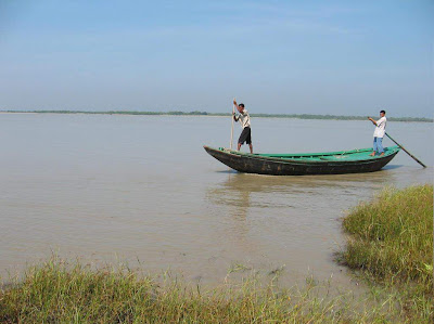
Wildlife viewing, Boating inside the forest, Fishermen, Honey Collection, Wood Cutting, Nature Study, Peace and Tranquility in the wilderness, seeing the world's largest mangrove forest and the riverside beauty.


CLIMATE:
Rainfall is heavy and humidity high (80%) due to the proximity of the Bay of Bengal. About 80% of the rain fall in the monsoon, which lasts from June to October. Mean annual rainfall varies from about 1,800 mm at Khulna, north of the Sundarbans, to 2,790 mm on the coast. There is a six-month dry season during which evaporation exceeds precipitation.
Conditions are most saline in February-April, the depletion of soil moisture being coupled with reduced freshwater flow from upstream. Temperatures rise from daily minima of 2-4°C in winter to a maximum of about 43°C in March and may exceed 32°C in the monsoon. Storms are common in May and October-November and may develop into cyclones, usually accompanied by tidal waves of up to 7.5m high (Seidensticker and Hai, 1983).
FAMOUS TOURISTS SPOTS:
- Hiron Point (Nilkamal): for tiger, deer, monkey, crocodiles, birds and natural beauty.
- Katka: deer, tiger, crocodiles, varieties of birds and monkey, morning and evening symphony of wild fowls. Vast expanse of grassy meadows running from Katka to Kachikhali.
- Kachikhali (Tiger Point): provide opportunities for wild tracking.
- Dublar Char (


CULTURAL HERITAGE:
There is Archaeological Evidence of earlier human occupation on the deltaic islands. The human settlements are indicative of the former presence of abundant freshwater, both from the Ganges and from non-saline ground water. Human occupation ceased in the 17th century, reportedly due to pirate attacks (Christensen, 1984).
LOCAL HUMAN POPULATION:
Approximately 2.5 million people live in small villages surrounding the Sundarbans. The area provides a livelihood at certain seasons of the year for an estimated 300,000 people, working variously as wood-cutters, fishermen, and gatherers of honey, Golpatta leaves (Nipa fruticans) and grass. Fishermen come in their boats from as far away as Chittagong and establish temporary encampments at various sites along the coast, where they remain until the approach of the monsoon season in April before returning to their homes.

SCIENTIFIC RESEARCH AND FACILITIES:
Considerable research has been carried out on the Sundarbans ecosystem and its wildlife. Hendrichs (1975) undertook a three-month field study of tiger, concentrating on the problem of man-eating and other vertebrates and invertebrates, in 1971. Other fauna1 surveys include those of Gittins (1981) and Khan (1986) for rhesus macaque, Khan (1986) for spotted deer, Sarker and Sarker (1986) for birds, and Sarker (1985a, 1985b) and Sarker (1985) for birds of prey.


MEANS OF COMMUNICATION:
From Khulna or Mongla Port, the only means of communication for visiting the Sundarbans is Water transport.
Transport like Motor launch, Speed Boats, Mechanized vessel might be hired for the visiting. From Dhaka visitors may travel by air, by road or by rocket steamer to Khulna (gateway of Sundarbans).
The most pleasant journey from Dhaka to Khulna is by Paddle Steamer, Rocket steamer. It presents a picturesque panorama of rural Bangladesh. Day/night long chair coach services by road are also available. The quickest way is by air from Dhaka to Jessore and then to Khulna by road.


Thanks a lot for viewing post.
Related posts:
Related posts:
A Human Habitation of Hilltracts and Forests
Daughter of Sea Kuakata Beach | Bangladesh
The Longest Sea Beach in the World | Cox's Bazar
Famous Tea Plantation in the World | Sylhet
Famous Mainamati, Lalmai and Shalvan Bihar | Comilla
Some historical and famous places in Early Dhaka
Bangladesh Tourism Sector Improvements
Daughter of Sea Kuakata Beach | Bangladesh
The Longest Sea Beach in the World | Cox's Bazar
Famous Tea Plantation in the World | Sylhet
Famous Mainamati, Lalmai and Shalvan Bihar | Comilla
Some historical and famous places in Early Dhaka
Bangladesh Tourism Sector Improvements
No comments:
Post a Comment